Methane on Mars
|

Methane on Mars

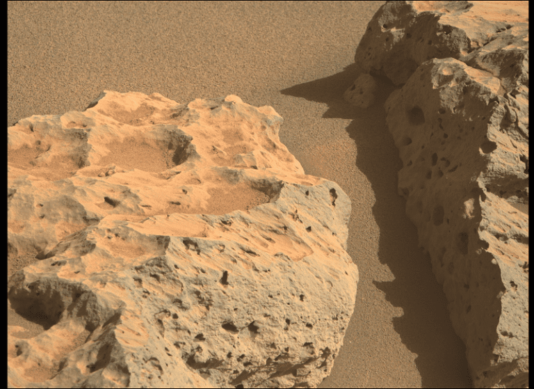
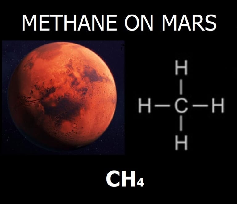
Methane on Mars Geologists understand that methane on Mars could relate to possible signs of past life, future sustainability, and similar geological processes to Earth. And sources of methane gas in the Mars atmosphere are presumably from biogenic and petrogenic processes. For example, microbial and thermal decomposition of underground organic matter, or tectonic and volcanic…

Geology of East Hollywood, Los Angeles, California

Geology of East Hollywood, Los Angeles, California

Geology of East Hollywood, Los Angeles, California & Hydrogeology This post summarizes the basic geology of the East Hollywood region of Los Angeles California. Some geological and hydrogeological data may be incomplete or pending review. Nonetheless, students, geologists, and earth scientists are welcome to openly use, critique, and contribute information. To do so, please refer…

Geologic Description of Mars Perseverance Sol 125 Photo
|

Geologic Description of Mars Perseverance Sol 125 Photo

Geologic Description of Mars Perseverance Sol 125 Photo This geologic description of Mars is possible due to public photographs by NASA’s Mars Perseverance rover. This photograph was taken on June 27, 2021 on Earth, or Sol 125 on Mars. The geologic description of Mars by this photograph may be incomplete or pending peer review. And…

Well Graded

Well Graded

Well Graded Soil Well Graded: In the soil classification process of geology, well graded soil represents a sedimentary soil sample that fully displays all of the possible grain sizes for that soil classification, in accordance with the Unified Soil Classification System (USCS). For example, a well graded sand (SW) comprises fine, medium, and coarse grains…

Poorly Graded

Poorly Graded

Poorly Graded Soil Poorly Graded: In the soil classification process of geology, poorly graded soil represents a sedimentary soil sample that only displays one or a few of the numerous other possible grain sizes for that soil classification, in accordance with the Unified Soil Classification System (USCS). For example, a poorly graded sand (SP) may…

Volcanology

Volcanology

Volcanology Volcanology: Volcanology is a branch of geology that focuses on the study of volcanos. In volcanology, geologists conduct field and laboratory investigations to learn about continental, coastal, and submarine volcanic activities. In fact, volcanology ties into many other branches of geology. For instance, a volcanologist may study the geochemistry of igneous rocks, such as…

Extrusive Rocks

Extrusive Rocks

Extrusive Rocks Extrusive Rocks: In the volcanology branch of geology extrusive rocks are igneous rocks that have been erupted onto the Earth’s surface, before forming and crystallizing. On the other hand, intrusive rocks form and crystallize under the Earth’s ground surface. Extrusive rocks are typically microcrystalline and aphanitic, because of the faster rate of cooling…

Confined Aquifer

Confined Aquifer

Confined Aquifer Confined Aquifer: In the hydrogeology branch of geology, a confined aquifer is an aquifer that is overlain (and underlain) by a layer of low permeability, such as clay, shale, or silty clay. In fact, the two confining layers contain the storage and flow of groundwater, such that the aquifer maintains hydraulic pressure (or…

Unconfined Aquifer

Unconfined Aquifer

Unconfined Aquifer Unconfined Aquifer: In the hydrogeology branch of geology, an unconfined aquifer is an aquifer that has a water table. In fact, an unconfined aquifer can only be the uppermost hydrogeologic unit and is particularly one that has no hydraulic head (or pressure) that is equal to atmospheric pressure. To illustrate, depth to groundwater…

Hydro-Geology (Hydrogeology)

Hydro-Geology (Hydrogeology)

Hydro-Geology (Hydrogeology) Hydro-Geology (Hydrogeology): Hydrogeology is a branch of geology that relates to the study of the earth’s natural groundwater and surface water systems. Whereby geologists study the physical and chemical properties of unconfined aquifers, confined aquifers, river systems, lake beds, oceanwater, natural geysers, and more.

Water Table

Water Table

Water Table Water Table: In the hydrogeology branch of geology, the water table represents the surface of an unconfined groundwater aquifer, where the hydraulic pressure is equal to atmospheric pressure. Additionally, a water table is present in a perched groundwater zone. Although, there is no water table in a confined aquifer.

Epicenter

Epicenter

Epicenter Epicenter: In the seismology branch of geology, an epicenter of an earthquake is the point on Earth’s surface that is directly above the focus (or hypocenter). It is the ground surface location overlying where an earthquake rupture originates within a dip-slip fault or strike-slip fault. Shortly after an earthquake, United States Geological Survey (USGS)…

Focus (Hypocenter)

Focus (Hypocenter)

Focus (Hypocenter) Focus (Hypocenter): In the seismology branch of geology, a focus, or hypocenter, refers to the specific place where an earthquake rupture originates. The focus, or hypocenter, underlies the epicenter when an earthquake occurs at a dip-slip fault, strike-slip fault, oblique-slip fault, or listric fault. In the event of an earthquake, geologists, and seismologists…

Connate Water

Connate Water

Connate Water Definition Connate Water: In geology, connate water is groundwater that has been trapped within the pore space of a sedimentary rock since its original deposition. Connate water is also referred to as “fossil water” due to a long history of non-exposure.

Feldspars

Feldspars

Feldspars Feldspars: In the field of geology, and the branch of mineralogy, feldspars are a mineral group, that is the most common amongst the earth’s crust. In fact, there are two types of feldspars: plagioclase feldspar and orthoclase feldspar.

Alquist-Priolo Earthquake Fault Zoning Act

Alquist-Priolo Earthquake Fault Zoning Act

Alquist-Priolo Earthquake Fault Zoning Act Alquist-Priolo Earthquake Fault Zoning Act: The Alquist-Priolo Earthquake Fault Zoning Act is a law that assists geologists to define “active faults” versus “potentially active faults.” The process entails using the same aging criteria as the United States Geological Survey (USGS) and the California Geological Survey (CGS). In fact, California policy requires…

Transgression

Transgression

Transgression Transgression: In geology, the term transgression is the formation of a specific sequence of sedimentary and metamorphic layers, that are the result of ocean water advancing onto land. To illustrate, when transgression occurs over millions of years, geologists find a layer of sand, overlain by shale, and overlain again by limestone. The opposite of…

Regression

Regression

Regression Regression: In geology, regression is the formation of a specific sequence of sedimentary and metamorphic layers, that are the result of ocean water withdrawing from the land. To illustrate, when regression occurs over millions of years, geologists find a layer of limestone, overlain by shale, and overlain again by limestone. The opposite of regression is…

Growth Fault

Growth Fault

Growth Fault Growth Fault: In geology, a growth fault is a strike-slip fault or dip-slip fault that moves contemporaneously with deposition. This causes the throw (amount of vertical displacement) to increase with depth and the strata to be thicker on the downthrown side as compared to the upthrown side.

Fault Scarp

Fault Scarp

Fault Scarp Fault Scarp: In the field of geology, a dip-slip fault scarp is a steep slope that is formed directly by fault movement. It occurs along the line of a normal fault, reverse fault, or transform fault. A fault scarp represents the planer surface of the fault before erosion and weathering modify it.

Fault Creep

Fault Creep

Fault Creep Fault Creep: Fault creep means slow ground displacement of a strike-slip fault or dip-slip fault, that usually occurs without accompanying earthquakes. Fault creep can derive from tectonic activity, or be the result of excessive petroleum and groundwater pumping.

Facies

Facies

Facies Facies: In the field of geology, the term “facies” represents a mappable, areally restricted part of a rock body that has different fossils or lithology from other contiguous beds deposited at the same time.

Provenance

Provenance

Provenance Provenance: In the field of geology, and the branch of geomorphology, the term “provenance” means the place of origin from which the constituent materials of sedimentary rock or facies are derived.

Environmental Consultant

Environmental Consultant

Environmental Consultant Environmental Consultant: An environmental consultant is an expert of any profession or field, who focuses their skills and knowledge towards matters that improve the environment. Environmental consultants are typically scientists with expertise in geology, chemistry, physics, and engineering. Environmental Consultants Working Towards Environmental Sustainability Environmental consultants generally provide professional services that aim towards…

Terrestrial Planet Definition

Terrestrial Planet Definition

Terrestrial Planet Definition A terrestrial planet is any planet in the universe that has earth-like composition, such as rocks, and other similar solid substances. For instance, Mars is a terrestrial planet in our solar system, whereas Jupiter is not. This is because modern geologists, astrophysicists, and astronomers understand Mars to contain solid formations correlative to…

Engineering Geology & Geological Engineering

Engineering Geology & Geological Engineering

Engineering Geology or Geological Engineering Engineering Geology: Engineering geology is also referred to as “geological engineering,” and is a branch of geology that relates to the study of earth materials and processes, that are juxtaposed to proposed structures such as buildings, retaining walls, dams, roads, pipelines, and more. Whereby geologists assess any potential levels of…

Seismology

Seismology

Seismology Seismology: (seis·mol·o·gy) a branch of geology and geophysics that relates to earthquakes, including but not limited to their causes, effects, hazards, and mitigation techniques.  Seismologists at the United States Geological Survey (USGS) use cutting-edge technology to measure seismic wave properties and geological hazards that trigger them or are triggered by them. In turn, seismology…

Environmental Geology

Environmental Geology

Environmental Geology Environmental Geology: (en·vi·ron·men·tal ge·ol·o·gy) a branch of geology that relates to the impact of human activity on Earth, and the pollution of geologic formations, reserves, and resources. Common focus points of environmental geology are contaminated soil, groundwater aquifers, lakes, rivers, and the ocean. Professional geologists assess and remediate contamination plumes in all media,…

Long Beach, California Geology & Hydrogeology
|

Long Beach, California Geology & Hydrogeology

Long Beach, California Geology & Hydrogeology This post summarizes the geology of Long Beach, California. However, some geological and hydrogeological data may be incomplete or pending review. Nonetheless, students, geologists, and earth scientists are welcome to openly use, critique, and contribute information. To do so, please refer to the comments function below. Ultimately, all post…