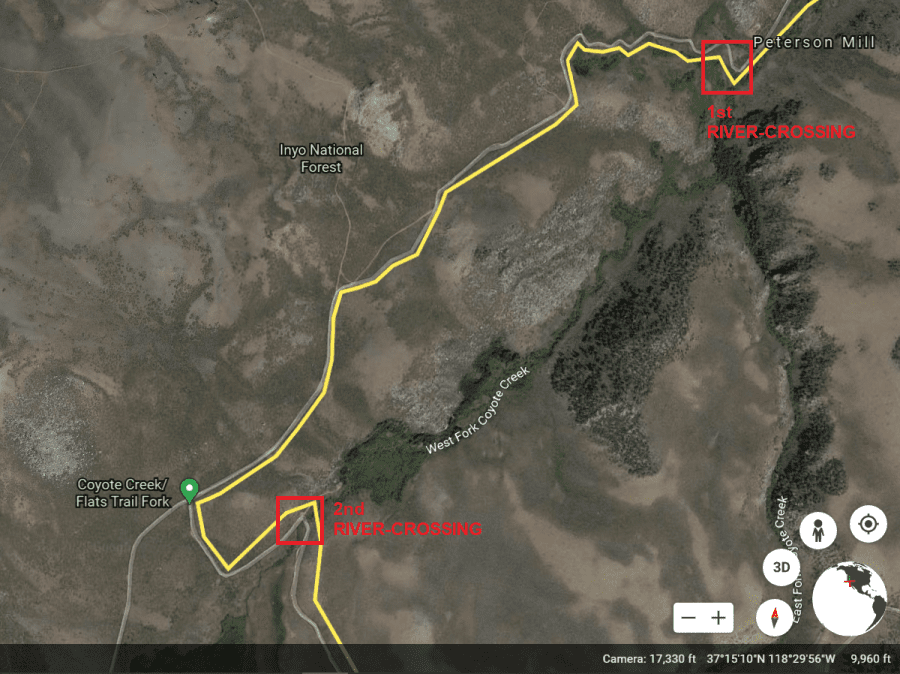
Aerial Image Map of Coyote Creek 4×4 Off Road Trail River CrossingsAerial Image Map of Coyote Creek 4×4 Off Road Trail River Crossings