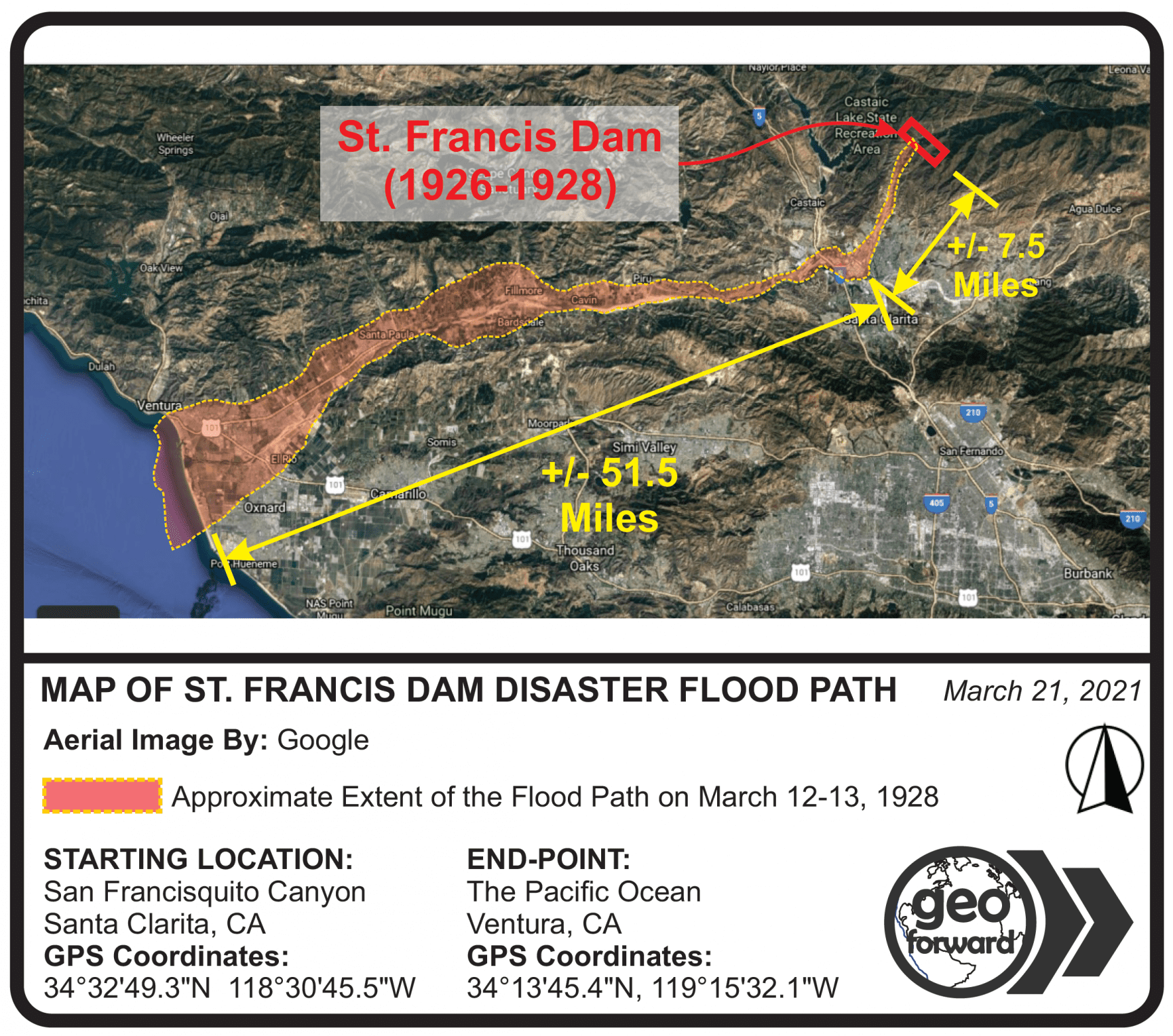
Map of St. Francis Dam Disaster Flood Path by Geo Forward 2021Related Posts:USGS 7.5 Minute Long Beach, CA Quadrangle 2018 Topo MapTorrance, CA Quadrangle 2018 USGS 7.5 Minute Topo MapHollywood, CA Quadrangle 2018 USGS 7.5 Minute Topo MapSalt Lake City North, Utah 2020 USGS 7.5 Minute Topo MapPlat Map DefinitionGeo Forward Main Page ContactLeave a Reply Cancel replyYou must be logged in to post a comment.