Similar Posts
Methane Alarm System
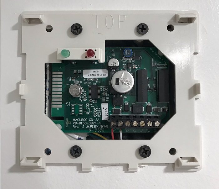
Methane Alarm System Methane Alarm System: As per the Los Angeles Department of Building and Safety (LADBS) Methane Code, Ordinance Number 175790, a methane alarm system is part of an active methane mitigation plan. A methane alarm system is a group of interacting components and circuits that synchronize to monitor and annunciate the status of…
Plutonic Rock (Igneous)
Plutonic Rock (Igneous) Definition The term “Plutonic” in the field of geology refers to an igneous rock, wherein the magma had originally cooled, solidified, and crystalized underground. A plutonic rock is generally coarsely crystalline (phaneritic) and is formed during a massive geologic intrusion of magma. In fact, outcropping (or daylighting) plutonic rocks are geologic features…
Twinning Definition
Twinning Definition Twinning is the observed intergrowth of multiple crystals in a symmetrical fashion. This term applies to the examination of rock thin sections, in the field of optical mineralogy.
Maximum Soil Screening Levels (MSLs)
Maximum Soil Screening Levels (MSLs) Maximum Soil Screening Levels (MSLs): MSLs are a list of risk-based hydrocarbon concentrations for soil pollution evaluations, that is developed by the California Regional Water Quality Control Board. These screening levels are based on the Leaking Underground Fuel Tanks (LUFT) Manual, for cleaning up soil contamination from leaking USTs. However, MSLs…
Design Methane Pressure (Soil Formation Pressure)
Design Methane Pressure (Soil Formation Pressure) Design Methane Pressure or Soil Formation Pressure: As per the Los Angeles Department of Building and Safety (LADBS) Methane Code, Ordinance Number 175790, Design Methane Pressure means the highest observed measurement of soil formation pressure during the methane testing process. In fact, a Design Methane Pressure measurement that is…
Seismic Moment
Seismic Moment Seismic Moment: In the seismology branch of geology, seismic moment represents a measure of the size of an earthquake, depending on the area of rupture, the rigidity of the rock, and the amount of slip from faulting.