Soil Compaction Testing or Soil Density Testing
Soil compaction testing, or soil density testing, is the process by which the density property of a soil mass is increased in the field by various means, and monitored by a professional geologist in accordance with local building department specifications. During the placement of engineered backfill material, density testing is necessary to evaluate whether the final soil compaction levels are adequate to support roads, bridges, building foundations, and more. This is a common geotechnical engineering laboratory procedure.
Soil Compaction Test Applications
Soil compaction services are necessary when completing underground storage tank removal and hydraulic lift removal projects. Building departments review the compaction data to ensure there are no risks of subsidence or settlement in the future. Similarly, soil compaction is required during the backfilling procedures of a soil contamination excavation remediation project. Testing frequency, locations, and procedures are part of the site-specific soil excavation management plan.
Field Values vs Laboratory Values
In order to conduct compaction testing of engineering fill at a job site, one must first determine the maximum dry density of the same soil in the laboratory. This value is a prerequisite to the field soil compaction testing process. And the final compaction measurement pertains to the relation between the field density values and the laboratory value.
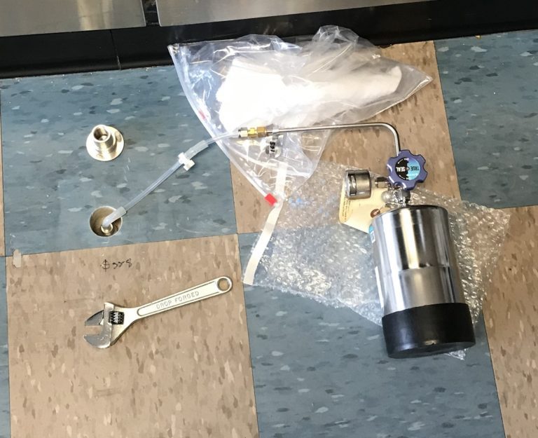
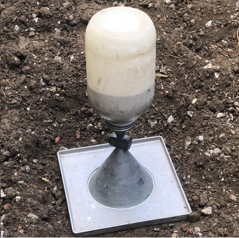
Methods of Soil Density Testing
The typical field soil compaction testing methods comprise using a nuclear meter, and a sand cone. Other test methods are less preferred due to their inefficiency in the field (such as a tube-density sampler or a balloon density device). Nonetheless, each of these devices produces the same result.
On the other hand, typical laboratory soil maximum dry density testing methods are defined for standard Proctor (ASTM D698, AASHTO T180), and modified Proctor (ASTM D1557, AASHTO T99) tests. The process involves mixing a soil composite from the site with water in the lab to determine variable moisture contents that are below and above the optimal moisture content. This is to ensure that a proper curve can be derived from the results.
The soil at each moisture content undergoes compaction in the lab, using a standard mold size and a specific number of weighted blows. Afterward, each sample is dried-out and weighed such that the moisture content and then dry density can be calculated. Once this process is performed on each sample, a proper compaction curve is plotted on a graph where the vertical axis represents dry density and the horizontal axis represents moisture content. The highest point in this curve translates the optimum moisture content of the soil as well as the maximum dry density values.
Relative Compaction Formula
Upon the determination of the maximum dry density and optimal moisture content of a composite soil sample in the laboratory, the determination of relative compaction can then be achieved. Relative compaction is simply the relation of dry density in the field to the maximum dry density in the lab.
Relative Compaction = [Dry Density (ρd) ÷ Max Dry Density (ρd)]