Fault Scarp

Similar Posts

  • Seismic Risk Definition

    Seismic Risk Definition Seismic risk is the probability that a subject site will be adversely affected by any seismic hazard, such as an earthquake. Seismic risk tends to increase in areas that are more earthquake-prone and vulnerable to damage. And vulnerability refers to the potential impact on people, as well as properties. For instance, places…

  • Maximum Soil Screening Levels (MSLs)

    Maximum Soil Screening Levels (MSLs) Maximum Soil Screening Levels (MSLs): MSLs are a list of risk-based hydrocarbon concentrations for soil pollution evaluations, that is developed by the California Regional Water Quality Control Board. These screening levels are based on the Leaking Underground Fuel Tanks (LUFT) Manual, for cleaning up soil contamination from leaking USTs. However, MSLs…

  • Control Panel for Methane Mitigation System

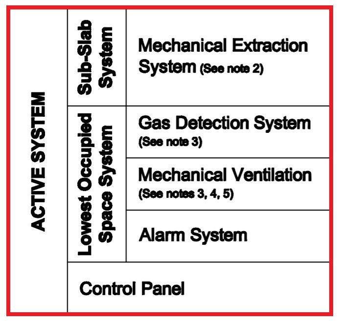
    Control Panel in a Methane Mitigation System Control Panel of a Methane Mitigation System: A methane mitigation control panel is the brain behind the active mitigation system. In accordance with the Los Angeles Department of Building and Safety (LADBS) Methane Code, Ordinance Number 175790, a control panel synchronizes methane alarm units with sensors and the…

  • Geology

    Geology Geology: Geology is a field of science relating to the earth, including but not limited to the earth’s resources, physical processes, chemical properties, history, and future. Additionally, the science of geology includes the study of other terrestrial planets, such as Mercury, Venus, or Mars. Branches of Geology There are numerous branches of geology that…

  • Embankment Dam

    What is an Embankment Dam? An Embankment Dam is a freshwater-retaining structure comprising excavated rock, soil, or a combination of rock and soil from nearby geological formations.  In fact, Embankment Dams are known as an “Earthfill Dam” when filled with soil, and a “Rockfill Dam” when filled with rocks. Earthfill Dams are most common. The…

  • Transmissivity

    Transmissivity Transmissivity: In geology and hydrogeology, transmissivity (T) represents the capacity of an aquifer to transmit water of the prevailing kinematic viscosity. Formula T=Kb, where b = saturated thickness of the aquifer. Dimensions are gallons per day per foot (gpd/ft) or feet squared per day (ft^2/day).