Maximum Soil Screening Levels (MSLs)

Maximum Soil Screening Levels (MSLs)

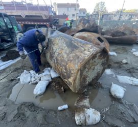
Maximum Soil Screening Levels (MSLs): MSLs are a list of risk-based hydrocarbon concentrations for soil pollution evaluations, that is developed by the California Regional Water Quality Control Board. These screening levels are based on the Leaking Underground Fuel Tanks (LUFT) Manual, for cleaning up soil contamination from leaking USTs. However, MSLs usually apply to evaluate total petroleum hydrocarbons in soils during Phase 2 Environmental Site Assessments and underground storage tank removal projects. Maximum Soil Screening Levels consider sample depth, groundwater depth, contamination source, and soil types.


Similar Posts

  • Potentiometric Surface

    Potentiometric Surface The term “Potentiometric Surface” means the hydrogeological surface that represents the total hydraulic head of groundwater from a confined aquifer or semi-confined aquifer that’s under pressure. The Potentiometric Surface of an aquifer is defined by the level to which water will rise in a groundwater monitoring well (that’s exclusively screened within said aquifer).

  • Rigidity

    Rigidity Definition Rigidity – In geotechnical engineering and engineering geology, rigidity represents the ratio of the shear stress and the amount of angular rotation that it produces, within a rock sample.

  • Methane Alarm System

    Methane Alarm System Methane Alarm System: As per the Los Angeles Department of Building and Safety (LADBS) Methane Code, Ordinance Number 175790, a methane alarm system is part of an active methane mitigation plan. A methane alarm system is a group of interacting components and circuits that synchronize to monitor and annunciate the status of…

  • Thermosphere

    Thermosphere Thermosphere: The thermosphere of a terrestrial planet is the fourth and final member of the atmosphere. On Earth, the thermosphere starts atop the mesosphere at approximately 85 kilometers above mean sea level. The upper limit of the thermosphere is reasonably presumed to terminate approximately 95 kilometers above mean sea level. In fact, most of…

  • Gap-Graded

    Gap-Graded The term “Gap-Graded” is used by geologists, engineers, and soil scientists in the geotechnical engineering field to describe the gradation of a soil sample, specifically when some particle sizes are missing. Aside from being “gap graded,” a soil sample can be described as “well-graded” (also referred to as poorly sorted), or “poorly graded” (or…