The St. Francis Dam Disaster
The St. Francis Dam disaster of 1928 was the failure of a large concrete gravity dam due to unmitigated geologic hazards, causing over 55 miles of violent flooding, and over 400 deaths. It is said to be California’s worst engineering catastrophe to date. Updated December 9, 2025.
Saint Francis Dam Facts
- Alternative Names: San Francisquito Dam; Saint Francis Dam
- Former Dam Location: The San Francisquito Canyon, Santa Clarita, CA (34°32’49.3″N 118°30’45.5″W)
- Builders: Los Angeles Department of Water & Power (Formerly the Bureau of Water Works and Supply)
- Start of Construction: July 1924
- Grand Opening: May 1926
- Dam Type: Concrete Gravity Dam
- Height: 185 – 205 feet
- Thickness: 150 feet (base)
- Width: 700 feet
- Estimated Maximum Water Capacity: 3,8361.10 acre-feet (12.5 billion gallons)
- Date of Collapse: March 12, 1928, at Approximately 11:45 PM to 11:57 PM
- Duration of Flood Disaster: March 12 through 13, 1928
- Estimated Death Toll: Over 400 People + Over 500 Animals and Livestock
- End-Point of Flood: The Pacific Ocean at McGrath State Beach, Ventura, CA (34°13’45.4″N, 119°15’32.1″W)
- Length of Flood Travel: Over 55 miles
- Demolition of the Remains: April 17, 1929, via Dynamite
- Cause of Failure: Improper Geological Evaluation of an Underlying Thrust Fault, Translational Landslide, and Other Seismic Risk Hazards
- California Registered Historical Landmark Number: 919
What was the St. Francis Dam Disaster?
The St. Francis Dam was a Los Angeles Water and Power (LADWP) project from 1924 to 1928. The dam officially opened in May of 1926 and stored roughly 3,800 acre-feet of drinking water. The purpose of the dam was to provide a secondary drinking water reserve for the growing City of Los Angeles. In fact, it was an accessory to the Los Angeles Aqueduct project, which pipes water from Owens Valley.
A Violent Flood Due to the Saint Francis Dam Failure
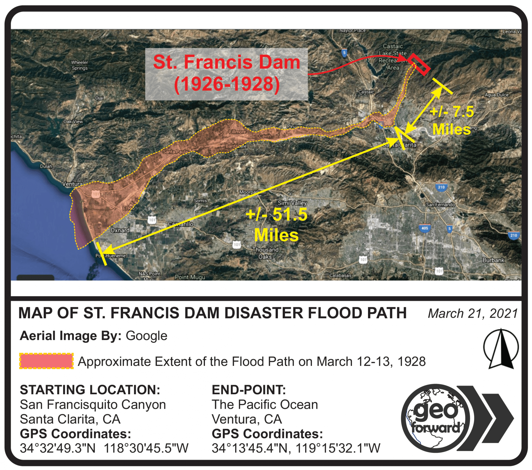
In the near midnight hours of March 12, 1928, the Saint Francis Dam collapsed. The dam’s failure caused a violent flood that destroyed acres of land and farms over 55 miles downstream. The floodwater terminus was the Pacific Ocean at Ventura Beach, California. Over 400 lives were lost due to the flooding. And thousands of acres of land, houses, bridges, roads, farms, and orchards were impacted. The image below shows the general flood path, from the site of the dam and into to the ocean.
Worst Disaster in California History
Historians believe the Saint Francis Dam disaster is the worst engineering catastrophe in the history of California. Casualties were swept from their homes during the midnight hours and discharged miles downstream. In fact, bodies and debris deposited into the ocean were later found as far as Santa Catalina Island.
Archived Footage of the St. Francis Dam
There is no actual footage of the St. Francis Dam failing because motion picture technology was very new at the time. It was a sudden and unexpected collapse, during the darkness of the midnight hours. Consequently, it left local videographers no opportunity to set up equipment to capture footage. However, there is footage covering the dam before failure, as well as after it.
Movies That Used Actual Footage of the Saint Francis Dam Construction
The following video is a clip from the 1926 film “The Temptress.” This clip contains actual footage of the St. Francis Dam being built, sometime between 1924 and 1926. This motion picture was released in 1926, before the San Francisquito Dam disaster.
All production credits for this clip belong to Metro-Goldwyn-Mayer (MGM) & Cosmopolitan Productions. The organization of the footage is courtesy of Santa Clarita Valley Public Television Programing (SCVTV).
Video Coverage of Santa Paula and Fillmore After the Saint Francis Dam Collapse
Hundreds of human and animal lives were lost from this catastrophe. Additionally, the flood leveled acres of land, as far as 55 miles downstream. The cities of Santa Paula and Fillmore are roughly 25 to 40 miles downstream from the St. Francis Dam disaster site. The following video is a compilation of footage of these areas after the flood. Geo Forward estimates these shots are from March 13 to 15 of 1928. This video captures damage to homes, farms, and orchards. It also covers roads and brides with severe damage.
Credits are not available pertaining to the producers of the footage above. Geo Forward presumes the footage was captured for newsreel purposes. Alternatively, there is a presumption the video has an affiliation with the American Red Cross for record-keeping purposes. Regardless, this video is currently available to the public via the Santa Clarita Valley Public Television Program (SCVTV).
Footage of Dynamiting the St. Francis Dam Remains
The next video captures the leftover center block of the Saint Francis Dam disaster, as well as the remaining western wing dike. The clip also shows workers dynamiting the remains into the rubble that exists today. Additionally, large fragments of the dam that were deposited downstream after the flood were also dynamited. These demolition events took place around April 17, 1929. And this is about one year after the St. Francis Dam disaster took place.
The reel starts by showing Water and Power employees carving cavities at the base of the leftover center block. These caves would be filled later with dynamite for demolition. Unfortunately, the actual explosion and take-down of the center block are not in this film. However, it does show workers coring the wing dike to insert dynamite sticks, as well as the dynamite explosions.
Credits for this footage apply to Twentieth Century Fox, as well as the University of South Carolina and the Santa Clarita Valley Public Television (SCVTV) program.
Who Built the St. Francis Dam?
Chief Engineer William Mulholland of the Los Angeles Water and Power Department built the Saint Francis Dam. Although, he was not alone in the process. Numerous other city officials, designers, and politicians were also responsible for it. In fact, the dam was an extension of the department’s ongoing Los Angeles Aqueduct project. Commencing in 1913, the LA Aqueduct Project continues to provide the City of Los Angeles with a sustainable drinking water source.
William Mulholland & Company
William Mulholland was a key player in the building-up of Los Angeles. His highest role was chief engineer of the department’s master plan for bringing drinking water to the growing City of Los Angeles. And his successful projects are responsible for the growth and sustainability of most Southern California cities today. Unfortunately, his role as a utilitarian has sparked political controversy during and after his lifetime. And the St. Francis Dam disaster adds more dissension to Mulholland’s legacy.
To illustrate, the failure of the Saint Francis Dam brought allegations of negligence and poor construction practices to trial. Although dam engineering practices at the time were not known to require geological research beforehand. The controversy of this tragedy continues to fuel members of opposing political and socioeconomic backgrounds today. However, the records and testimonies analyzed during the post-failure hearing led to the final ruling, that there had been no acts of negligence or recklessness.
Despite all public contentions, many historians today understand that Mulholland’s intentions for the St. Francis Dam were utilitarian. The Saint Francis Dam was purposed for the success of the City of Los Angeles, and for the greater good of Southern California.
The Film “Chinatown” Reflects William Mulholland and Los Angeles Water & Power History
The 1974 Hollywood film Chinatown is about a water-scandal story involving the Los Angeles Department of Water and Power (LADWP). It is widely believed that the main characters of the movie are loosely based on Mr. William Mulholland. The storyline takes place in Los Angeles shortly after the failure of a dam. There is a reasonable presumption that “the dam” in the movie refers to the St. Francis Dam disaster. For example, in the movie, the LADWP Chief Engineer Hollis Mulwray (whose character alludes to William Mulholland) opposes the construction of a new dam after the previous “disaster that killed hundreds of people.”
The Sequel Further Covers Los Angeles History
Additionally, the 1990 sequel to the movie Chinatown was The Two Jakes which also covers a historical Los Angeles scandal. However, it’s less about the Water and Power Department, and more about housing developers and the petroleum industry. For example, the movie shows active oil derricks all around the city. And a series of natural gas explosions also occur throughout the film due to lacking geological and environmental safety evaluations. This parallels the recent methane explosions around Los Angeles oil fields, which are now officially “methane zones.” As a result, modern standards require methane testing in Los Angeles, as well as methane mitigation plans and methane barrier installations for public safety reasons.
What type of Dam was St. Francis Dam?
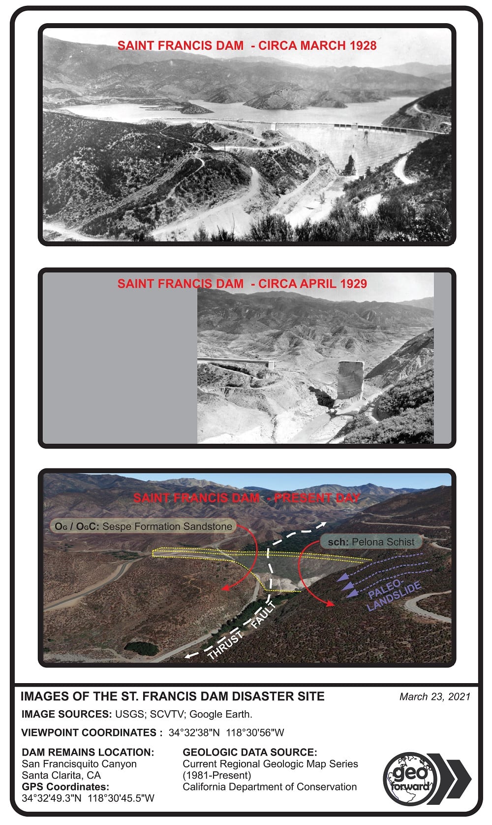
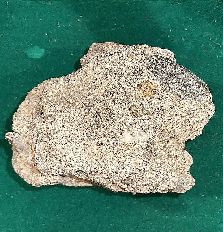
The Saint Francis Dam was a Concrete Gravity Dam that was wider at the base than the top. The former Saint Francis Dam comprises a base that’s approximately 150 feet wide and rises approximately 205 feet above the streamline. The former dam comprises concrete, with iron reinforcement and aggregate rocks of the local geologic formations. For instance, fragments in San Francisquito Canyon reveal gravel and cobble size aggregates of the Sespe Formation sandstone, as well as the Pelona Schist.
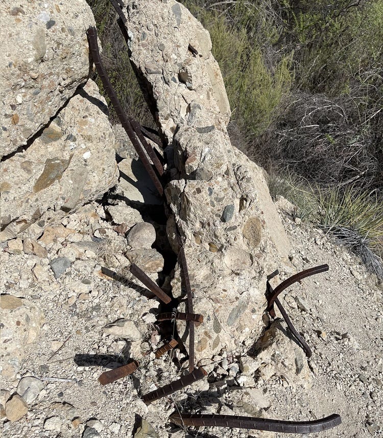
Officials report the decision to demolish the leftover remains of the St. Francis Dam was for public safety. Although some historians believe it was an attempt to remove the memory of the catastrophe. Modernly, the ruins exist as a series of concrete blocks and rubble. In fact, it appears to even match the natural topography of San Francisquito Canyon area. Today, the ruins reveal some protruding rebar reinforcement and plumbing mechanisms of the dam. And some dynamite cores are also visible in the ruins.
How Much Water Did the Saint Francis Dam Hold?
The St. Francis Dam held approximately 12.5 billion gallons, or 3,8361.10 acre-feet, of water at a time. The mainframe of the dam was the concrete gravity structure which retained the largest portion of water by volume. Additionally, the western wing dike allowed more water retention over the tributary canyon areas. This area now consists of San Francisquito Canyon Road.
Where is the St. Francis Dam Location?
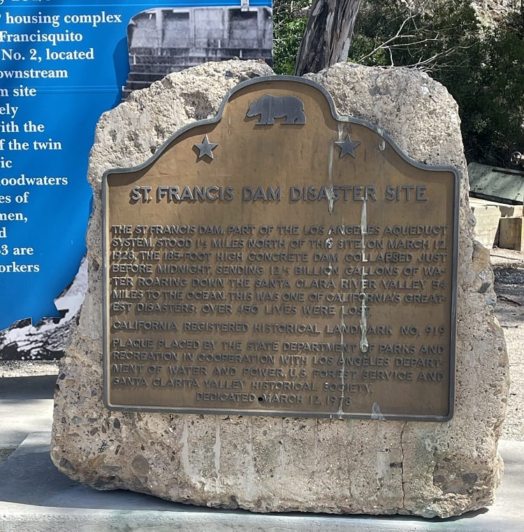
The St. Francis Dam location is directly within San Francisquito Canyon, in the City of Santa Clarita, CA (34°32’49.3″N 118°30’45.5″W). In order to get to the St. Francis Dam disaster site, one can drive approximately 7 miles upgradient on San Francisquito Canyon Road, passing the entrance to Drinkwater Flats OHV and the LADWP Power House #2 on the right-hand sides. There is an old asphalt road with barricades that trends south from the right-hand side of San Francisquito Canyon Road. This is a walkable access road that leads to the St. Francis Dam disaster site. Unfortunately, this road contains no signs or plaques to identify the dam. However, the picture below is a placard at LADWP Power House #2, just a short distance downstream.
Thousands of Pieces of the Dam Remain Downstream
The failure of the St. Francis Dam dispersed thousands of concrete chunks miles downstream, as well as a few massive fragments. In fact, at least six massive fragments of the dam are identifiable downstream via an aerial map review and site visit. The areal map below demonstrates the current positions of some of the remaining large fragments. Although numerous other large fragments exist in vegetation areas outside of the map.
The Largest Remaining Fragment is Still Downstream
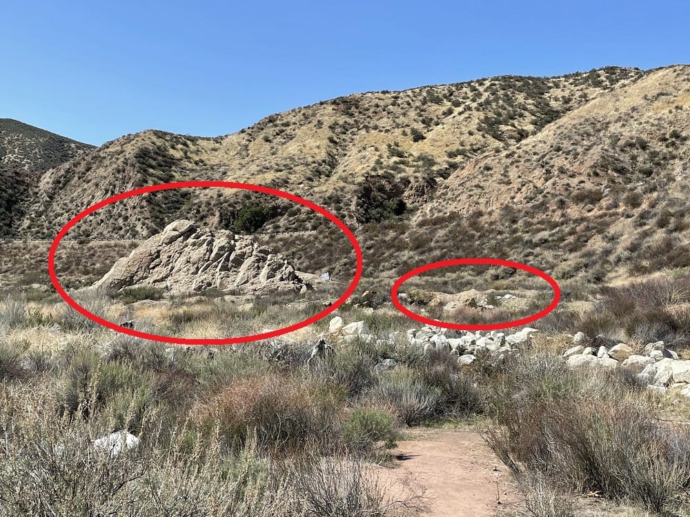
The largest fragment of the former Saint Francis Dam exists about 0.25 miles downstream of the disaster site itself. Forensic analysis indicates this massive block comes from the upper-eastern abutment of the former dam. It was also dynamited in 1929, along with the remains of the main structure and other massive blocks. And modernly, it appears as if it’s just a giant deteriorated concrete boulder. A forensics report presumes this fragment is about one-fourth the mass of the former dam. Even after demolition, the ruins of this block roughly span 115 feet long, 65 wide, and 35 feet high. Today, scientists remain in awe about the intensity required by the flood to displace this large of a block a quarter-mile downstream.
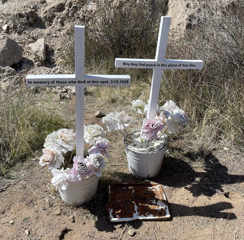
Today, civilians and visitors upkeep makeshift memorials for the victims of the Saint Francis Dam failure. For instance, the image below is a memorial at the location of the largest downstream fragment. Additionally, there is an abundance of graffiti on the old asphalt service road leading to the St. Francis Dam disaster site.
San Francisquito Canyon
San Francisquito Canyon is in the Saugus area of Santa Clarita, California. This area is part of Los Angeles County, but still outside of the Los Angeles City limits. San Francisquito Canyon Road currently trends through the canyon. The road begins downgradient at the Copper Hill Road intersection. The upgradient direction of the canyon leads to the Lancaster area of Los Angeles County. The Saint Francis Dam disaster site is approximately 7.5 miles upgrade from Copper Hill.
Early Gold Mining in the St. Francis Dam Disaster Site Location
San Francisquito Canyon forms along the streamline of San Francisquito Creek, which cuts into the Sierra Pelona Mountains. Naturally, the San Francisquito Canyon creek produces an abundance of gold nuggets. In fact, the location of the St. Francis Dam disaster site has a unique history of gold mining by Spanish Missionaries of the San Fernando Mission in the early 1800s. Gold mining in the San Francisquito Canyon actually occurred before gold was discovered at Sutter’s Mill in Coloma California, and before the California Gold Rush in 1845.
The Saint Francis Dam’s Name is a Modification of San Francisquito
The St. Francis Dam was supposed to be named after the canyon it was located in (the San Francisquito Canyon). “San Francisquito” is a Spanish name that comes from the Spanish Missionaries of the San Fernando Mission in the early 1800s. However, the politicians and builders of the dam chose not to call it the San Francisquito Dam. Instead, they insisted on applying an English-western spin-off of the canyon’s true name. As a result, the word “San” was replaced with its English translation word “Saint.” The name “Francisquito” was modified to a new name “Francis.” There is no information as to why city officials at the time chose to convert the name of the dam into an English-western one. However, it is reasonable to presume this was an act of public relations, which reflects the intolerance of ethnic diversity in America during the 1920s.
What Caused the St. Francis Dam to Collapse?
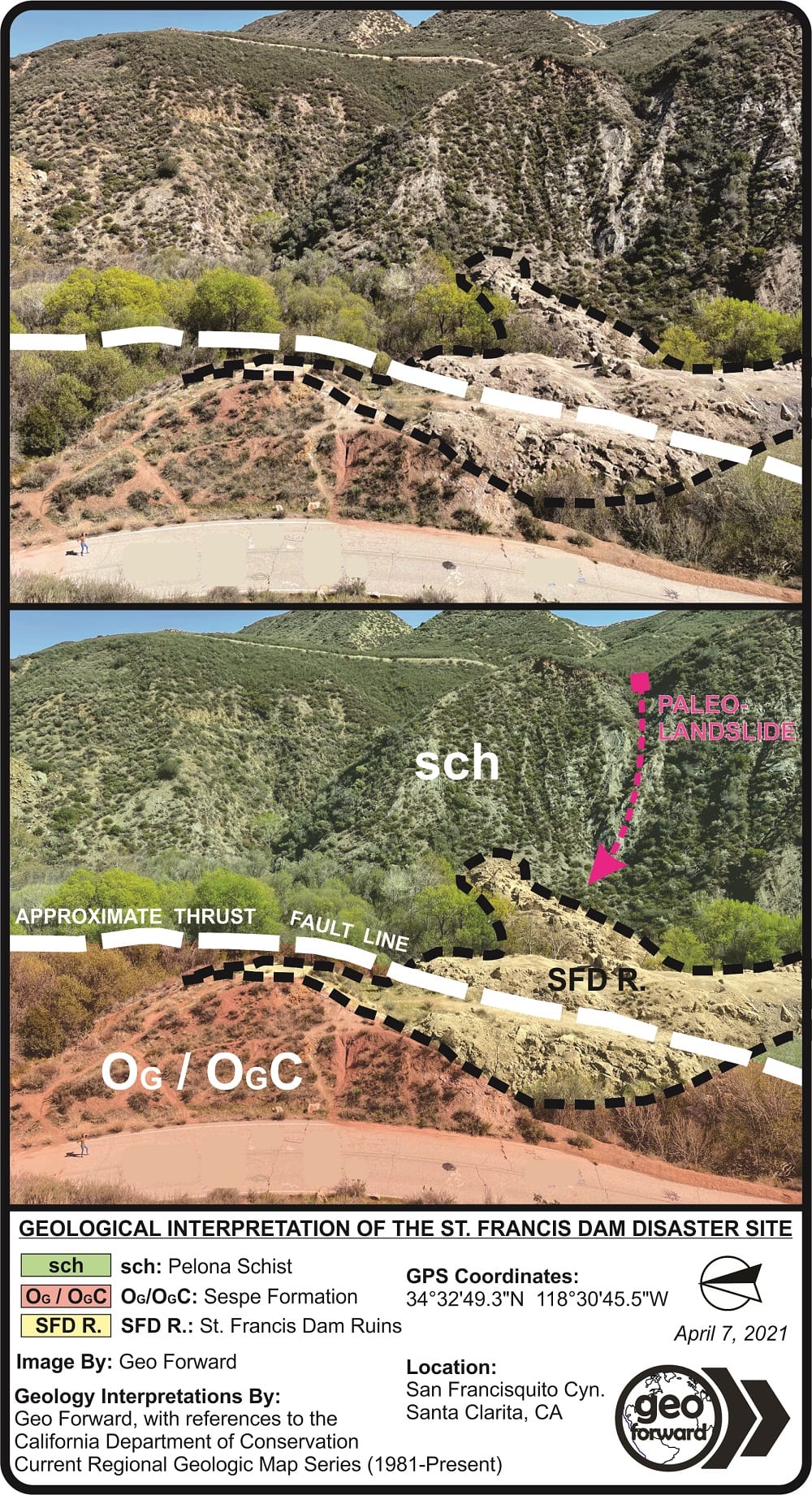
Improper geologic evaluations of an underlying thrust fault and a translational landslide, as well as poor operations and maintenance, caused the Saint Francis Dam to collapse. To illustrate, the former dam’s eastern abutment overlays a paleo-landslide of the Pelona Schist. Whereas the western abutment overlays the Sespe Formation sandstone, which slakes when saturated. Moreover, this geologic contact forms over an active thrust fault that trends directly under the former St. Francis Dam footing. Today, geologists also believe the increased saturation and hydrostatic pressure from the dam further reduced the structural integrity of the underlying Sespe Formation, Pelona Schist landslide, and the contact thrust fault.
1). Dam Building Standards in the 1920s Weren’t as Good as Today
At the time the Saint Francis Dam was built, geological investigations and seismic hazard mitigation designs were not standard practices for dam construction. In fact, most structures were built without the consultation of a professional geologist before 1924. Nonetheless, it’s mistakes like the St. Francis Dam disaster that incentivize building departments and public works agencies to require geological evaluations and hazard mitigation plans moving forward.
2). A Lack of Geological Hazard Evaluation Before Building
One of the main reasons the dam failed, was because there hadn’t been a geological evaluation of the San Francisquito Canyon site beforehand. After almost 100 years of research, forensic scientists conclude that preliminary geologic research would have prevented the catastrophe from happening. Nonetheless, modern dam construction procedures do require a geological team to prepare a full suite of due diligence reports at the pre-planning stages. For example, environmental site assessments provide insight into historical land uses and recognizable environmental conditions of the area. Whereas geotechnical investigations and engineering geology studies help determine the underlying soil conditions and risk of fault or landslide hazards. Moreover, geophysical surveys and hydrogeological assessments assist with understanding seismic risk and groundwater conditions.
3). A Lack of Geologic Hazard Mitigation Plans
The root causes of the St. Francis Dam disaster were the landslides of the eastern abutment, slaking wet sandstones of the western abutment, and active thrust fault under the footing. However, losses due to slope movement and fault activity can be strongly reduced when proper engineering practices for hazard mitigation occur. Geologists today can reduce the risk of these hazards by re-grading, establishing land-use controls, and managing drainage or runoff systems. Engineers can further prevent structural failure by designing system components that mitigate site-specific geological hazards.
4). Insufficient Dam Operations & Maintenance Procedures
Another cause for failure was insufficient operations and maintenance (O&M) procedures. According to briefings of the post-disaster hearing, there were numerous reports of leakages, cracking, and loud knocking sounds at the dam in the days leading to its collapse. In fact, there were even reports of “muddy water” flushing through the western abutment on March 12, 1928, by dam keeper Tony Harnischfeger. Despite these warnings, there was a failure by executives to recognize the urgency of the dam’s standing. Consequently, there were no orders to drain or even temporarily shut down the dam for an immediate safety inspection on the days leading up to March 12, 1928.
On the other hand, it’s possible these warnings and reports may have come to light in too short of a timeframe for dam executives to reasonably act on. However, modern-day dam facilities follow a strict O&M procedure, that accommodates an immediate shutdown in the case of an emergency. Perhaps a proper O&M procedure for the St. Francis Dam would have resulted in an emergency shutdown and post-drain inspection of the structure, just before it reached a point of total failure.
Geology of the Saint Francis Dam Area
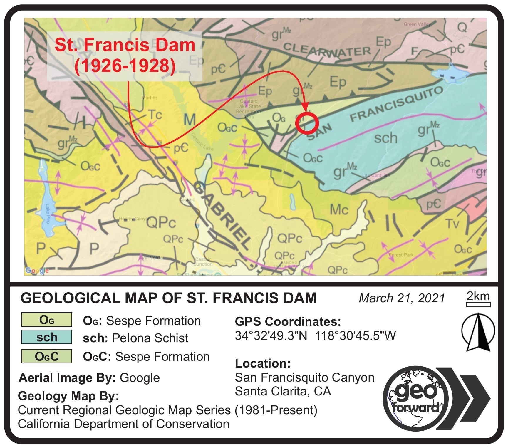
The former St. Francis Dam structure overlays a thrust fault that separates two major geologic formations (the Sespe Formation and the Pelona Schist). Each of these geologic units, as well as the fault between them is a failure point to the once-overlying concrete arch dam. The dam’s formerly eastern abutment contacts a south-southwest dipping outcrop of the Pelona Schist. Whereas the former western abutment contacts the sandstone bedrock and alluvium of the Sespe Formation. Moreover, the Pelona Schist comprises a translational landslide hazard, and the Sespe Formation significantly reduces shear strength during water saturation. Similarly, the underlying fault plane loses cohesive strength due to saturation and added normal weight.
Underground Fault Plane Failure Point
The western abutment of the former St. Francis Dam overlies the Sespe Formation. The eastern abutment overlies the Pelona Schist. Each of these units forms a geologic contact via a thrust fault. In fact, the fault line trends directly under the Saint Francis Dam disaster site, and proceeds northwesterly through San Francisquito Canyon.
Weakening of the Fault & Abutting Formations
A fault zone such as this, under normal conditions, already poses a threat to any structure, as well as the adjoining formations. However, the water retention process of the dam itself further compromised the fault zone. To illustrate, the fault plane was overlain by the dam structure, as well as roughly 3,800 acre-feet of water. So there was a massive increase of normal force, hydrostatic pressure, and water intrusion into the fault zone, caused by the retained water above it. Consequently, the cohesive strength and structural integrity of the fault zone (as well as the bedrock of the western-block Sespe Formation and eastern-block Pelona Scheist) were weakened to the point of failure.
Sespe Formation Western Failure Point
The Sespe Formation is a Late Eocene to Late Oligocene sedimentary geologic formation that exists throughout the Western Transverse Ranges geomorphic province. Its type locality (or the location of its first recognition) is along the Sespe Creek in the Topatopa Mountains. The Sespe Creek is a tributary that flows from the north into the Santa Clara River near the city of Filmore, about 30 miles downstream of the St. Francis Dam disaster site.
Sandstones, Conglomerates, and Alluvium
At the location of the Saint Francis Dam disaster site, the Sespe Formation displays a reddish-brown to brownish-red series of alluvium over sandstone and conglomerate bedrocks. Although the formation can also comprise similar-appearing siltstones. Much of the formation is grey or brown in other areas of the Western Transverse Ranges as well. Moreover, the formation has a history of continental deposition (non-marine sediments), and can also contain fossils in some areas.
The alluvial deposits within the formation comprise a series of sand and gravel grains that can range in size from fine to coarse and have subangular to subround features. Additionally, cobble and boulder-size clasts exist and are mostly round to subround. The Sespe Formation sediments are presumably river channel deposits. Its content includes a variety of dissimilar igneous rock clasts, such as the local granites, diorites, and more.
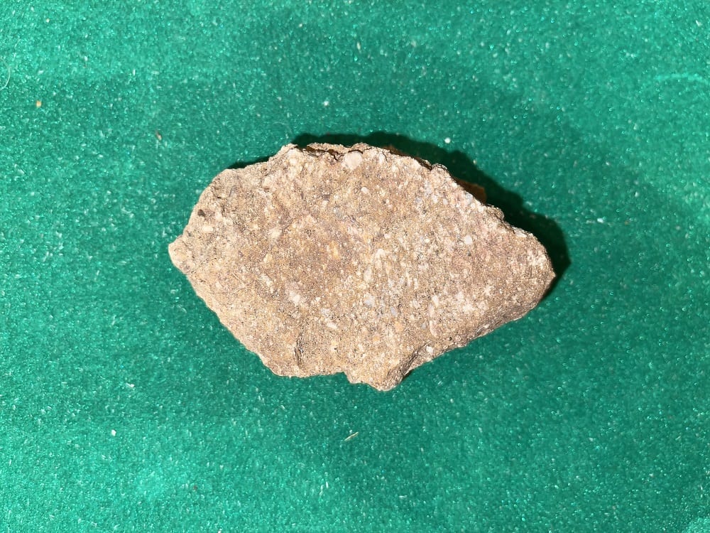
Western Abutment of the Saint Francis Dam
A review of the site-specific geology of the St. Francis Dam disaster site reveals the entire western abutment of the dam solely relied on the Sespe Formation. This was one of three failure points of the structure. The others were the mid-stream thrust fault and eastern translational landslide. In fact, briefings of the post-failure hearing indicate there had been reports of “mud water” leaking from the Sespe Formation, at the western abutment just hours before the catastrophe (dam keeper Tony Harnischfeger’s emergency call on March 12, 1928).
Over-Saturation of the Sespe Formation
Because the dam was retaining water approximately 200 feet above the original streamline, the Sespe Formation was fully contacting and absorbing water. In fact, after the Saint Francis Dam disaster, laboratory investigations determined increased water content as well as applied hydrostatic pressure from retention, significantly weakened the integrity of the Sespe Formation bedrock. As a result, these sandstones and conglomerates changed in volume, density, and cohesive strength, and began deteriorating under the dam’s footing. And this failure was demonstrated by the reports of Sespe-colored mud-water breaking through the western abutment on the day of the disaster.
Pelona Schist Eastern Failure Point
The Pelona Schist is a greenschist facies metamorphic rock from the Late Cretaceous to Early Tertiary periods. Outcrops of the bedrock exist throughout the Southern California geomorphic provinces. Although it is most prevalent in areas of the San Gabriel Mountains, as well as the San Francisquito Canyon area. In the St. Francis Dam disaster area, the Pelona Schist mostly occurs as a dark greenish-gray rock with strong foliation.
The Pelona Schist comprises albite, muscovite, and quartz minerals. Additionally, other trace minerals exist within it in the San Gabriel Mountains, such as graphite, epidote, and more. In fact, research geologists believe the protolith to the Pelona Schist were shallow marine sedimentary rocks, such as fine-grain sandstones, siltstones, and shales. Over millions of years of heat and pressure applications, the chemical and physical reactions of the metamorphosis process alter the shallow marine rocks into schist.
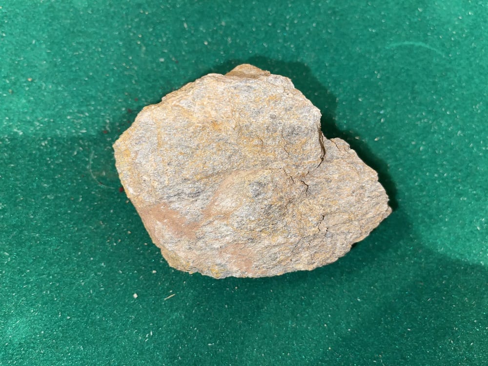
Paleo-Landslide at the Eastern Abutment of the St. Francis Dam
The entire eastern abutment of the St. Francis Dam disaster site comprises the Pelona Schist. And this is also one of the failure points of the dam. The other two failure points are the underlying thrust fault and western-block Sespe Formation. The Pelona Schist has strong foliation characteristics, which exist as sheet-like layers. This allows the schist to easily split apart, and slide along planes. Thus, a translational landslide hazard exists when the fracture plans are in a similar direction to the outcrop’s downward slope.
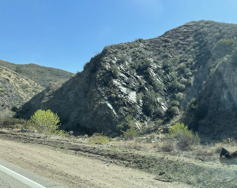
Preventing Another Disaster
Building a dam for drinking water retention will cause more of a disturbance to the earth’s natural condition than almost any other type of engineering marvel. Geologists and engineers design dams to seal the flow of surface water, as well as groundwater underneath it. Unfortunately, the 1920s construction standards didn’t include a preliminary geological assessment prior to the construction of a dam. Nonetheless, the St. Francis Dam disaster reveals the importance of studying the geology of an area before building. It brings to light the importance of proper engineering practices to mitigate geological hazards, as well as proper operations and maintenance procedures during use. Today, there are four primary geological considerations before dam construction:
- Foundation material soundness and ability to withstand loads via calculations.
- The degree of water-tightness of the foundation material as well as the means necessary to make all materials appropriately water-tight.
- The effects of long-term water exposure to the foundation materials.
- The seismic risk and potential for landmass movement at the dam site via geological investigation.
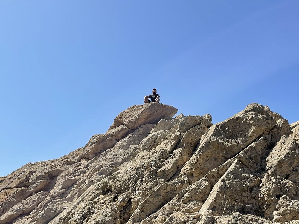
Modern Geologists Investigate Future Dam Sites
Forensic analysts conclude that the St. Francis Dam disaster would have been avoided if there had been a proper geological survey of the site before erecting the dam. Today, geologists play a major role in the site assessment and impact analysis of future dam sites. Field geologists also conduct feasibility studies and hydrogeological investigations per the four considerations above. And to be certain, continuous testing, calculation, and risk assessment updates are necessary during any dam construction process.
Detailed geological evaluations provide enough data to conclude as to the soundness of bedrock, the level of seismic risk, and the permeability of underlying formations. Hydraulic engineers also review the criteria presented by geologists and collaborate to design a safe and operational dam.
Authors:
Written By: Adam Azad Kaligi, California Professional Geologist Lic. #9287
Co-Written By: Michael Joseph Sabo, Environmental Earth Scientist

